Saturday 16 September 2017

DOODLE MAPS (Self Initiated Project)..

I've always been interested in maps that somehow tell stories and these are really just an extension of that same thread..

A set of hand-illustrated, written notes and anecdotes on an informal 'overlay' upcycling free and existing tourist leaflet maps.. The first experiment spanned two years and over two holiday visits to the lovely little Spanish island of Menorca.. It's a bit like an insider's guide: recording and quickly sketching experiences, top tips, thoughts, warnings etc through personal experiences.. My latest 'Doodle Map' is a hand-illustrated overlay (ongoing) over a free tourist map of the county of Shropshire, UK.


A Shropshire Doodle Map.
(Click to enlarge)


A Menorca Doodle Map.
(Click to enlarge)

An example of one of my notebook doodles close-up..

Wednesday 19 July 2017

Latest Interactive Googlemap Trails & 'Virtual Tour' Ideas..

I'm still evolving ideas for formats and methods to help show interactive Googlemaps of trails as well as 'virtual tours' via Google Earth videos of routes taken.. 

• Here's another couple of examples: 

• One shows the interactive Googlemap of a small cycle ride tested recently (this has sketches, thoughts, pictures and phone video recollections embedded in it) which are triggered manually by the user/viewer.. 

• The other shows the potential via Google Earth to show the same routes in video format and the various elements appear as you move along the route.. They're only really 'proof of concepts' at present but you begin to see how this sort of media might be used in different applications..

• It can be a collaboratively-created map too and have numerous people feed-in and link/add content to the map..

• Click on any icon and it'll display in a sliding window left of the map. If you only get a portion of an image in this 'tray' then just click the image and it'll open as a whole..

Original interactive Googlemap of sample route:


Google Earth video tour of same route (linear, manually controlled):
Background audio courtesy of Bensounds.com


Google Earth tour of an eve walking route in the Brecon Beacons (no audio):


Friday 7 July 2017

Sample Walky-Cake Googlemap

Just a quick test post showing how an interactive Googlemap of our outdoors w/e could look. It's only really got a few examples of content in at the mo' - but you can already see that there are pics linked, videos linked, drawings, thoughts and comments etc, etc..

• It can be a collaboratively-created map too and have numerous people feed-in and link/add content to the map..


• Click on any icon and it'll display in a sliding window left of the map. If you only get a portion of an image in this 'tray' then just click the image and it'll open as a whole..

Monday 9 January 2017

Sample Interactive Google Map of Worcester

This is an example interactive google map I've developed for a student workshop project (and then re-used/developed in further projects at the university). It shows a route plotted around central Worcester. We then tried to best 'fit' the road patterns to this circle and then walked the route recording sights, sounds, imagery, graffiti and conversations heard.

This is how the initial recorded quick sketches look and then how we can translate these to view via an interactive Google Map with help from students.

[ Click to enlarge ]


For more information see our project website:
http://worcs-locative-research.blogspot.co.uk/


Wednesday 15 June 2016

Bumblebee Creatives: Recent Mapping Freelance Projects

Just to quickly record a couple of recent freelance mapping commissions for clients in the region.

Client The Fold, Bransford nr Malvern
Nature of map: To be included in a print brochure discussing the various cycle rides that the Fold aims to promote in it's vacinity.
•Format: Full colour, digital
Digital map showing 3x circular cycle routes.
(Click on map to see on it's own).

Client: Malvern Hills District Council
Nature of map: To be included in a print brochure discussing children's heritage trail of the town and helping to show it's extent.  
Format: Full colour, digital, colourscheme and typeface use pre-set acc to guidelines.
Digital map showing the route of the Children's Heritage Trail.
(Click on map to see on it's own).


Tuesday 26 April 2016

New Teme Valley Cycle Trails - Devt/User Testing Regime..


Examples of the various draft circular route sheets in the Teme Valley.
We've just completed draft mapping the first set of new moderate ability/family-oriented circular cycle trails in the Teme Valley for Malvern Hills District Council's 'Teme Valley Trails' scheme. In line with our recent test walks in the same area we're now looking to get small groups of people together to properly test the cycle routes on occasional sundays in the next few months.

The informal user-test method has proven really useful for the 6x walks we've created as part of the Teme Valley Trail (see previous post on this blog) and we're keen to continue the testing regime with the new cycle trails too. As with the 6x walking route maps, there are also 6x cycle trail maps - they vary from 'easy' (mainly flat on minor roads/lanes) to 'challenging' (including occasional steep up or downhill sections and occasional small sections of green lane).

Each cycle route will have sites to look at en route that may be of interest - including rural churches (both ruined and intact), family farms and ancient downland racecourses to name but some.

Weather-allowing, we'll try to pre-plan in cycle test groups on occasional sundays throughout May, June and (if needs) early July. I'll post updates in advance to those interested via e-mail along with meet locations/timings, clothing & kit suggests and a .pdf copy of the A4 route map to be tested on the day.

Additionally (you'll be pleased to hear), each route has been designed so it incorporates either a cafe en route or a pub in case cyclists wish to quench their thirst (and ruin all that good done with crisps and cake)..

Provisional dates and rides: (Weather permitting, all distances & times approximate)

Ride 1: Completed
Sunday 8th May - Stanford on Teme, Riding: easy

' Some of the best cycling lanes in Worcestershire' - Lyndon, Bracewell, CTC Worcester

Pictures from the test ride:
Our draft route sheet for the day..
Some of our test group for the day on the quiet lanes around Shelsley Walsh.

Intricate woodwork and carvings inside Shelsley Walsh's little church.

More like a cycle ride in deepest France, some of the lovely scenery en route.


Ride 2: Completed
• Sunday 29th May - Martley, Riding: easy

Our draft route sheet for the day.

Our test team enjoying a reviving cold drink post ride.

Wichenford Dovecote (Free Entry, National Trust)

The amazing half-timbered barn next to Wichenford Dovecote

One of the incredibly well-preserved ancient wall paintings in Martley Church.


Ride 3: Completed
• Sunday 12th Jun - Bransford, Riding: easy

Our draft route sheet for the day.
A cathedral of wood - the amazing Leigh Court Barn (en route).

We passed fields full of poppies.

Post ride discussion and feedback on the route.

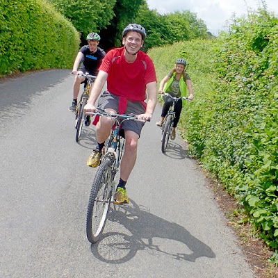
Some of our test cyclists out on the route.


Ride 4: Completed
• Sunday 19th Jun - Tenbury Wells, Riding: easy-medium

Our draft route sheet for the day.

Outside Tenbury's 'Pump Rooms'.

Slowly riding up one of the two hills encountered.

The front and rear of our group as they cross Oldwood Common.


Ride 5: Completed
• Sunday 26th Jun - Pencombe/Bromyard, Riding: medium-tough

The draft route map for the day.. With added Daleks!

Our excellent cycling test team for the day..

Coming down the fantastic downhill section from the hill at
Shortwood family farm.

Stopping for a quick breather..

Ride 6: Completed
• Sunday 10th July - Cleobury Mortimer, Riding: medium-tough

Our draft route sheet for the day..

Our excellent test team for the day..

The lovely little church at Neen Savage.

Our test folks taking refuge in the New Inn..

Daughter Libby and yours truly on a break at the New Inn.

To heck with the rain! :)

Yes, count me in?
 If interested in joining us for some informal testing, then please e-mail me initially on: bumblebee.email@gmail.com

Many thanks, Andy :) 

Students Re-Design Teme Valley Trail System for Local Council

Graphic Information Design students from the University of Worcester have recently helped to create a new trails system for Malvern Hills District Council. 

The requirement from the council's Economic Development Unit was initially to help re-design their trail leaflet - which consisted a single tourist leisure drive. In addition, the council wanted students to help create 6x new family circular walks and cycle rides in the region too as well as linked visual concepts for information boards and wayfinding signage.

Economic Development Officer for Malvern Hills District Council Malcolm Salisbury reviewed final student work and adds:

"It was great to see the final examples of student work, many of them had really got to grips with the Teme Valley Tour visual system brief too - we look forwards to developing some of these project ideas further.."

Client Malcolm Salisbury oversees some of the final student designs.
Some of the content of the original leaflet.
The eventual re-design, initiated by students and finalised by myself.
The area covered by the new scheme showing the 6x new
walk and 6x new cycle routes.
A typical walking route A4 card (designed and mapped by myself).
Each walk and cycle route is to be 'user tested' by small groups of
volunteers to make sure that we can call them 'tried and tested' on release.
One of our many walking test groups.